Snowdon, a mighty peak that needs no introduction, is one of the most famous and popular landmarks in North Wales. But what are the best routes up Snowdon?
As the highest mountain in Wales and England, Snowdon dominates the Snowdonian skyline and is on many people’s bucket lists. Whether you’re looking for a challenge, a charity hike or just wanting to admire the magnificent views, there are many ways to conquer this mighty mountain.
Take on one of the six paths to the summit of Snowdon and enjoy views of Snowdonia, Anglesey, the Llyn Peninsula and even Ireland as you stand tall at 1,085m high. Each route offers something different – from hidden waterfalls to unique views.
Keep reading to discover the best routes up Snowdon…
Six Routes Up Snowdon
There are six incredible routes up to the summit of Snowdon; The Llanberis Path, The Pyg Track, The Miners Path, The Rhyd Ddu Path, The Watkin Path and The Snowdon Ranger Path. All paths vary in difficulty, duration and distance but all showcase the breathtaking beauty of Snowdonia National Park perfectly. This is definitely one of the most beautiful places in Wales.
Before setting off, make sure you are fully prepared for climbing Snowdon. Plan your route carefully, check the weather forecast and make sure you have all the correct kit with you. As, unless you’re taking the Snowdon Mountain Railway to the top, you’ll need to be prepared for a good 6-8 hour hike and unpredictable weather conditions. Here’s a little bit more information on each of the six routes up Snowdon;
1. The Llanberis Path

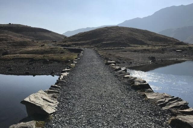
The longest and most gradual route to the summit of Snowdon, The Llanberis Path is the most popular and easiest option. The path follows the Snowdon Mountain Railway track up from Llanberis and offers fantastic views of Cwm Brywynog, Llanberis and across the Menai Strait towards Anglesey.
Choose this Snowdon route if… this is your first time climbing Wales’ highest peak or you’re with young children.
Total Distance: 9 miles (14.5km)
Duration: 6 hours (approx.)
Ascent: 948m
Starting Point: Far end of Victoria Terrace, Llanberis, off the A4086 (LL55 4TD)
Parking: Multiple car parks in Llanberis
Route Details: The Llanberis Route
2. The Pyg Track

A classic Snowdon route, The Pyg Track is one of the shortest walking routes up Snowdon, with the least ascent. However, this route can be steep and rocky in places and is far from being the easiest route up Snowdon.
It is believed that the path was named after Pen y Gwryd Hostel by climbers who stayed there and offers stunning views down to the idyllic lakes and up to the dramatic knife-edge of Crib Goch.
Choose this Snowdon route if… you’re after epic views of the Snowdon Lakes (Llyn Llydaw and Llyn Glaslyn) and of Crib Goch and Y Lliwedd.
Total Distance: 7.3 miles (11.7km)
Duration: 5-7 hours (approx.)
Ascent: 704m
Starting Point: Pen-y-Pass (LL55 4NU)
Parking: Pen-y-Pass Car Park. Must pre-book 24 hours in advance or take the Sherpa Park and Ride Service from Nant Peris and Llanberis.
Route Details: The Pyg Track
3. The Miners Track
Starting at Pen-y-Pass, The Miners Track runs parallel to the Pyg Track and is one of our favourite walks in Snowdonia. The route starts gradually, walking alongside shimmering lakes, before a steep ascent to the summit, merging with the Pyg Track at Llyn Glaslyn.
Many people combine the two routes and climb to the summit of Snowdon along the Pyg Track and then descend via the Miners Track.
Choose this Snowdon route if… you prefer a circular walk, rather than an out and back route. Combine it with The Pyg Track for a stunning Snowdon experience.
Total Distance: 8 miles (12.9km)
Duration: 5-7 hours (approx.)
Ascent: 723m
Starting Point: Pen-y-Pass (LL55 4NU)
Parking: Pen-y-Pass Car Park (LL55 4NY). Must pre-book 24 hours in advance or take the Sherpa Park and Ride Service from Nant Peris and Llanberis.
Route Details: The Miners Track
4. The Snowdon Ranger Path

As one of the oldest routes up Snowdon, the Snowdon Ranger Path is one of the easiest options and much quieter than the popular Llanberis Path. Despite this, there is limited parking and fewer facilities than at the start of the Llanberis Path.
The route, starting at the Snowdon Ranger Youth Hostel, takes you along a rocky track before joining the Llanberis Path and making its way up to the summit. On route, you’ll be treated to incredible views of the surrounding valleys, lakes and dramatic peaks.
Choose this Snowdon route if… you’re looking for a quieter alternative to the Llanberis Path with views of Moel Hebog and Mynydd Mawr.
Total Distance: 8 miles (12.9km)
Duration: 6 hours (approx.)
Ascent: 936m
Starting Point: Llyn Cwellyn Car Park (LL54 7YT)
Parking: Pay and Display Llyn Cwellyn Car Park
Route Details: The Snowdon Ranger Path
5. The Watkin Path

A challenging climb, starting at almost sea level, meaning you’ll be conquering the full 1,085 height of Snowdon. But don’t let this put you off, the views from The Watkin Path are second to none.
The route takes you through enchanting woodlands, alongside idyllic waterfalls and through the dramatic Cwm Llan. Named after Sir Edward Watkin, this steep route offers breathtaking views of Llyn Llydaw and Crib Goch and is well worth the hard work.
Choose this Snowdon route if… you’re up for a challenge and want to have the full Snowdon experience.
Total Distance: 8 miles (12.9km)
Duration: 6-7 hours (approx.)
Ascent: 1,015m
Starting Point: Across the road from Nant Gwynant Car Park (LL55 4NR)
Parking: Pay and Display at Nant Gwynant Car Park
Route Details: The Watkin Path
6. The Rhyd Ddu Path

Used as the first official ascent of Snowdon in 1639, The Rhyd Ddu Path is one of the quietest routes up Snowdon. Boasting world-class views of Nantlle Ridge and the surrounding scenery, The Rhyd Ddu Path offers a different perspective of this stunning mountain. Combine this route with the Snowdon South Ridge for one of the best circular routes on Snowdon.
Choose this Snowdon Route if… you want to experience a different side of Snowdon, away from the busy alternatives.
Total Distance: 7.5 miles (12km)
Duration: 6-7 hours (approx.)
Ascent: 890m
Starting Point: Rhyd Ddu Car Park (LL54 6TN)
Parking: Pay and Display at Rhyd Ddu Car Park
Route Details: The Rhydd Ddu Path
Snowdon Parking and the Snowdon Sherpa Service
Snowdonia National Park is an extremely popular area, with thousands of people visiting every year. Make sure you plan ahead and use the Sherpa Bus Service and Pen y Pass car-park booking system to make the most out of your trip.
If you’re taking on The Miners or Pyg Track, you can now pre-book a parking space at Pen y Pass, with ticket fees contributing towards the running of sustainable transport and maintaining the paths on the mountain. Or why not make the most of the Snowdon Sherpa Service, with regular shuttles from Llanberis or Nant Peris Car Park.
After conquering one of these fantastic routes up Snowdon, head back to your delightful holiday cottage in Snowdonia and reflect on your amazing achievement.
Or why not have a read of our list of mighty mountains in Snowdonia or guide to climbing in North Wales to start planning your next adventure.
Image Credits: John S Turner, Jeff Buck (CC BY-SA 2.0), Scott Wylie (CC BY 2.0)
